I often use this column to write about references to the Biblical world from outside of the Bible. It helps to confirm the accuracy of the Bible to read a reference to a person, place or event from external contemporary sources. But there is no doubt that it is even more exciting to see pictures of Bible people or Bible places. One scholar believes he has identified an overlooked portrayal of Jerusalem from 2,700 years ago. First, let’s review a few well-known examples.
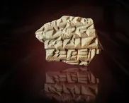
Considered the earliest map of the world, a Babylonian clay tablet held at the British Museum dates to 600 BC and shows the world as a disk with Babylon at the centre. The map includes the Euphrates River, distant regions and outer oceans. It also shows the locations of Assyria and Urartu (Ararat). The map indicates where the Babylonians thought that the ark had landed after the great flood of ancient history.
The later Madaba Map (c.570 AD) is a beautiful mosaic floor to be seen at a Greek Orthodox church in Jordan. It is an extensive map of the Holy Land and includes a detailed pictorial map of the city of Jerusalem. Originally made up of over 1million stones, the mosaic would have stretched for 21 metres. Even today, the remaining 16 metres are an impressive sight. Apart from the details of Jerusalem, the map includes 150 different named places including Bethlehem, Hebron, Jericho and Samaria. Some of the illustrations are magnificent, depicting fish, boats and houses.